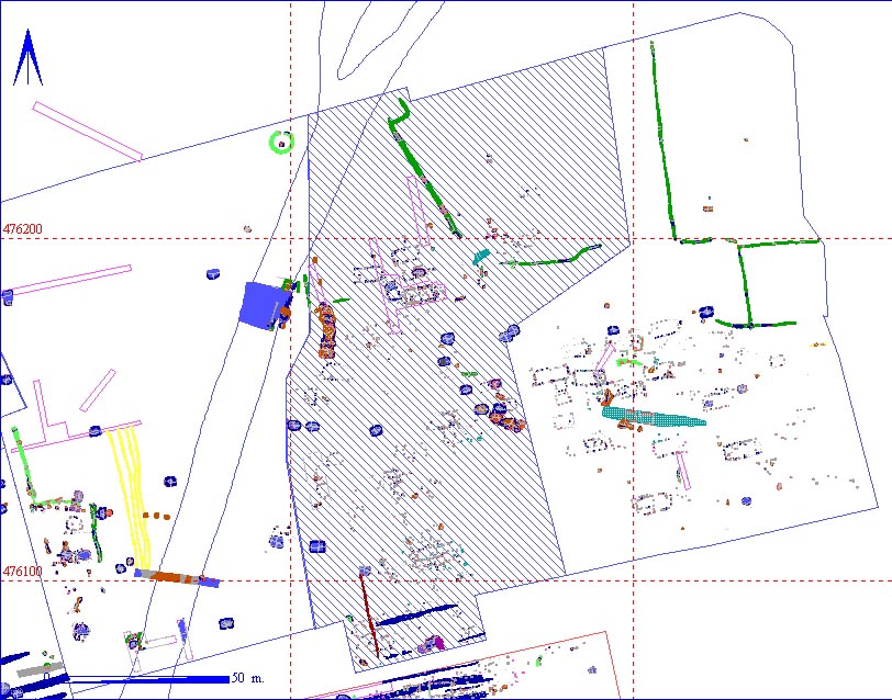
Area 2CB highlighted in red


002CB00001     Machine Stripping


Area Details
Length 164 m Width 90 m Depth 10
Area  123333.48  sq. m Volume
Material Culture Number of Objects 0 Number of Animal Bones 1
Environmental 

Stratigraphic Matrix Diagram

                                    002CB00001             
                                                 
                     002CB00002               002CB00063     002CB00080   002CB01534  
                                                 
    002CB00033   002CB00012   002CB00021    002CB00024   002CB00037   002CB00039   002CB00040   002CB00038       002CB00121   002CB00122    
                                                 
 002CB00206 = 002CB00034       002CB00244                                    
                                                 
                            002CB00250                    
                                                 
                    002CB01275   002CB00890       002CB02347    002CB00462            
                                                 
                                002CB01503 002CB00513  = 002CB00514        
                                                 
                            002CB02580 = 002CB01871                

The matrix diagram above shows all of the spits and layers in Area 2CB indicating their relationship to each other. Click on the spit number which you wish to see in more detail. The bold, flashing (Netscape browser only) context indicates the current catalogue entry.

Discussion

As the machine stripping is the removal of the ploughsoil, this context is subsequently above all other features and spits. This was the central segment of the large area exposed in 1986. To the west, the limit was defined by the relict stream channel. The area can be subdivided into three geomorphological zones. The first is a gravel fan in the north of the area, bounded in the west by the stream channel and in the east by a colluvial deposit. To the south and south-west, the gravel gives way to a silty sand, which is sealed by a surviving early ploughsoil. To the east of this, the ground rises slightly to a knoll of lumpy chalk, partially quarried away in the post-Medieval period.

The area contained 15 Grubenhäuser, 20 post hole structures, a series of gravel quarry pits and a pit complex, as well as part of a Roman enclosure system in the north.

Context Details

 
KEY_ID TYPE SHAPE L B D PROFILE NOTES
002CB00001 SPIT COMPLEX 16400 8978 10 UNDULATING INITIAL MACHINE CLEARANCE OF AREA 2CB.


Animal Bones

KEY_ID SPECIES ELEMENT QUANT CHEW BURN BUTCH FBRK
002CB00001 SHEEP/GOAT M/T br 1 1 0 0 1