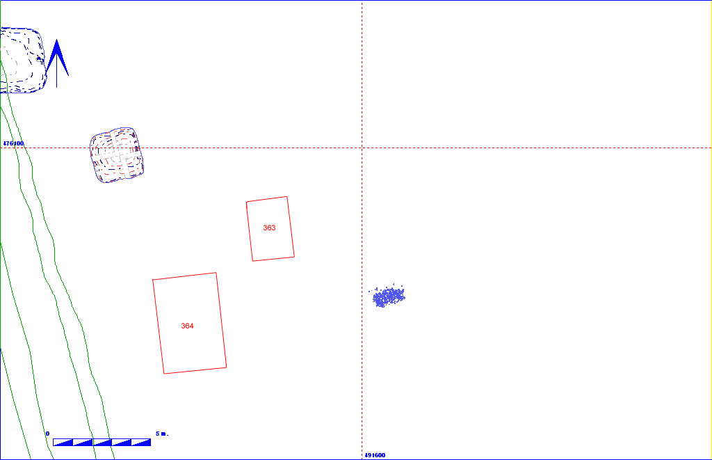
Shows location of buried soil 2DB363 in relation to the rest of Site 2


002DB00363     Buried Soil


Layer Details
Length 350 Width 300 Depth 8
Area  10.5 sq. m Volume
Material Culture Number of Objects 3 Number of Animal Bones 13
Environmental 

Stratigraphic Matrix Diagram

                 002DB00001                                                           
                                                                           
                                                                           
                 002DB00002                           002DB00007                              
                                                                           
            002DB00031   002DB00023       002DB00009   002DB00006                   002DB00092                   002DB00044      
                                                                           
                002DB00091                                                   002DB00048      
  002DB00151      002DB00148                           002DB00220       002DB00222   002DB00080   002DB00139           002DB00128          
                  002DB00145           002DB00079                                            
  002DB00167   002DB00161                                 002DB00150       002DB00131         002DB00138   002DB00152          
                  002DB00149           002DB00297                                       002DB00246    
      002DB00254                                       002DB00140   002DB00143   002DB00208     002DB00141   002DB00228          
                    002DB00197                                                      
              002DB00262                                                 002DB00229          
                                                  002DB00363   002DB00364   002DB00144            
                                                                           
                                                            002DB00146              
                                                                           

Discussion

This was the smaller of two rectangular areas (with 002DB00364), excavated into the shallow buried soil deposit. Both of these areas were initially thought to indicate the location of Grubenhäuser, although excavation demonstrated that this was not the case, as a chalk gravel natural was reached after a few centimetres. The material removed was a sandy silty loam (Munsell colour 10YR 4/3, although colour lightens slightly with depth), with moderate angular and rounded chalk inclusions. One of the finds was a stamped Anglian pot sherd.

002DB00363 Object Totals by Period and Material


002DB00363 Animal Bone Totals by Species


Context Details

KEY_ID TYPE SHAPE L B D PROFILE NOTES
002DB00363 BURIED SOIL GRID DEFINED
350
300
8
CONCAVE ONCE THOUGHT A GRUB LURKING HERE DUE TO DENSITY OF FINDS BUT PATCHES NATURAL CHALK REACHED AFTER A FEW CMS-MANY FINDS-INCLUDING ANGLIAN-MIDDEN? DESCRIPTION AS 362.


Objects

Animal Bones