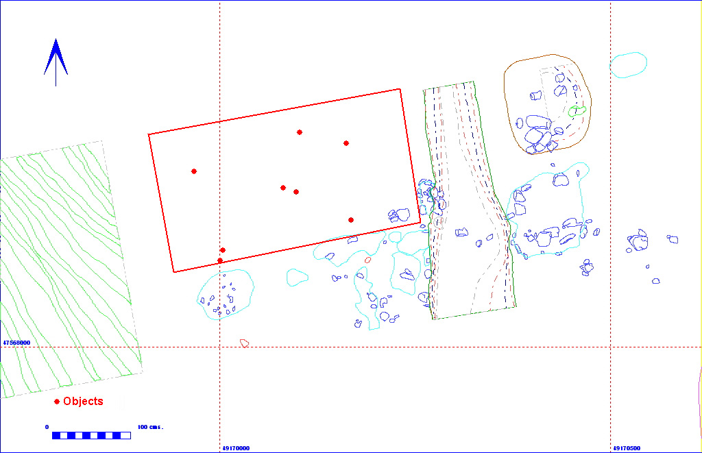
012AG00036 Spit
| Spit Details |
| Length |
300 |
Width |
150 |
Depth |
30 |
| Area |
4.5 sq. m |
Volume |
|
| Material Culture |
Number of Objects |
9 |
Number of Animal Bones |
0 |
Stratigraphic Matrix Diagram
The matrix diagram above shows an extract of the spits from Area 12AG
indicating their relationships to each other. Click on the spit number
which you wish to see in more detail. The bold, flashing (Netscape browser
only) context indicates the current catalogue entry.
Discussion
This spit was located immediately to the north of spit 012AG00035,
in a similar attempt to define the demolition layer comprising 012AG00020
and 012AG00037. In the event, very little
of the demolition layer was found, indicating that most of the northern
limits had already been revealed by spit 012AG00035.
The material removed was in effect the same as 012AG00035,
a sandy clay loam (Munsell colour 10YR 3/3), with 30% angular chalk inclusions
(<10cm in diameter). Finds include seven later Roman pot sherds.
012AG00036
Object Totals by Period and Material
Context Details
| KEY_ID |
TYPE |
SHAPE |
L |
B |
D |
PROFILE |
NOTES |
| 012AG00036 |
SPIT |
RECTANGULAR |
300
|
150
|
30
|
FLAT |
SPIT ADJACENT TO 00035 REVEALS SOME OF 00020
BUT GENERALLY MISSES IT. |
Objects