The matrix diagram above shows an extract from the full matrix from Area 12AG. Click on the number which you wish to see in more detail. The bold, flashing (Netscape browser only) context indicates the current catalogue entry. You may need to pan around using the slider at the bottom of the screen.
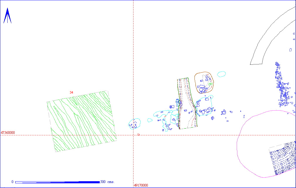
An unusual series of thin linear features (012AG00034) cut into the sandy gravel natural were noted, and this is where the initial excavation in this trench was halted. Interpretation of the function of these features has varied from wheel ruts in a hollow way to sheep trails (highly unlikely!), with the current view being that they were the remains of some form of timber shuttering, possibly the foundations for a timber structure.
These features were then sealed by layer 012AG00025, in effect an irregular
interface between 012AG00034 and the colluvial layer (012AG00033) above.
This was a sandy loam with very few (but large) angular chalk inclusions
(2%), and a Munsell colour of 10YR 4/4. It was roughly equivalent to spit
012AG00024.
Next (012AG00032) was a layer of apparently rapid colluviation, a sandy
clay loam with over 20% angular chalk inclusions (Munsell colour 10YR 4/3).
This was sealed by a sandy silty loam (012AG00031) with very few chalk
inclusions (Munsell colour of 10YR 4/3). It marked a period of rather more
steady silting, sandwiched between two more rapid colluviation events.
It was roughly equivalent to spit 012AG00023.
Both 012AG00029 (Munsell 10YR 3/3, chalk inclusion rate 40%) and 012AG00030
(Munsell 10YR 4/3, chalk inclusion rate 30%) were rapid colluviation events,
sandy clay loams sealing 012AG00031.
These were both sealed by 012AG00028, a sandy clay loam (Munsell colour
10YR 4/2), which was interpreted by the excavator as a stabilization layer
of buried soil, roughly equivalent to spit 012AG00021.
Finds from the various layers were lifted under the spit numbers, thus the only find from this group of layers was from the linear features, a single late Roman sherd.

| KEY_ID | TYPE | SHAPE | L | B | D | PROFILE | NOTES |
| 012AG00025 | LAYER | SUB-RECTANGULAR | FLAT | SURFACE-2D WHERE WHEEL RUTS? AT BOTTOM OF 34 CUT INTO SAND NATURAL SLOPES DOWN STEEPLY TO THE EAST | |||
| 012AG00028 | BURIED SOIL | OVERALL | UNDULATING | STABILIZATION LAYER COLLUVIAL DEPOSIT FILLING HOLLOW AND SEALING DEMOLITION DEPOSITS INCLUSIONS OF CHALK ANGULAR 15%<10CM SLUMPS FROM WEST | |||
| 012AG00029 | LAYER | OVERALL | UNDULATING | THIS IS HILLWASH DEPOSIT ON E OF TRENCH COMES DOWN ONTO NATURAL INCL=40% ROUNDED CHALK<3CM+PEA GRIT | |||
| 012AG00030 | LAYER | OVERALL | UNDULATING | COLLUVIAL UPPER FILL TO HOLLOW. EPISODE OF FASTER SILTING ANGULAR CHALK INCLUSIONS OF<10CM 30% | |||
| 012AG00031 | LAYER | OVERALL | FLAT | STEADY SILTING EPISODE IN BETWEEN TWO FASTER EPISODES OF COLLUVIATION INCLUSIONS OF CHALK <5CM 10% | |||
| 012AG00032 | LAYER | RECTANGULAR | FLAT | THIS MARKS INTERFACE BETWEEN 00031 AND PRIMARY SILT OF LARGE HOLE AND MARKS A PERIOD OF RAPID COLLUVIATION INCLUSIONS OF ANGULAR CHALK <10CM 20% | |||
| 012AG00033 | LAYER | RECTANGULAR | UNDULATING | INCLUSIONS OF ANGULAR CHALK<10CM 2% ABOVE SURFACE 00025 WHICH CONTAINS WHEEL RUTS? BOTTOM FILL TO HOLLOW WAY FILL RESULTANT FROM GRADING BETWEEN NATURAL+00031 | |||
| 012AG00034 | RUTS? | LINEAR | UNDULATING | MASTER NUMBER ISSUED FOR ?WHEEL RUTS IN ?HOLLOW WAY IN DEEP TRENCH 12AG. |
| KEY_ID | OB | PERIOD | MATERIAL | TYPE | SUB_TYPE | CLASS | No |
| 012AG00034 | AA | 4C | POTTERY | SHERD | OPEN? |
1
|