
|
|
| Layer Details | |||||||
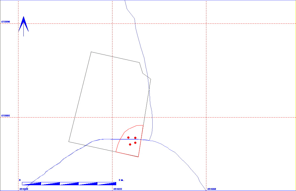
| Length | 200 | Width | 110 | Depth | 20 | ||
| Area | 2 sq. m | Volume | |||||
| Material Culture | Number of Objects | 4 | Number of Animal Bones | 0 | |||
| Environmental | |||||||
| 011BD02000 | ||||||
| 011BD02001 | ||||||
| 011BD02002 | 011BD02003 | |||||
| 011BD02004 | ||||||
| 011BD02006 |
The matrix diagram above shows an extract of the spits and layers from a small area in 11BD indicating their relationships to each other. Click on the spit number which you wish to see in more detail. The bold, flashing (Netscape browser only) context indicates the current catalogue entry. If you wish to see the full spit matrix for areas 11AD (1990), 11BD (1991) and 11CD (1992), then click here.
| KEY_ID | TYPE | SHAPE | L | B | D | PROFILE | NOTES |
| 011BD02007 | LAYER | COMPLEX |
200
|
110
|
20
|
IRREGULAR | WET BLACK CLAY AT SE CORNER OF FLOT SUMP TRENCH. DEEPEST AT SE CORNER. MAJORITY ONLY 4CM DEEP. LAYS ON COMPACT CHALK NATURAL 2005. |
| KEY_ID | OB | PERIOD | MATERIAL | TYPE | SUB_TYPE | CLASS | No |
| 011BD02007 | AA | STONE | STONE | SANDSTONE |
1
|
||
| 011BD02007 | AB | STONE | STONE |
1
|
|||
| 011BD02007 | AC | MEDIEVAL | POTTERY | SHERD | GREEN GLAZED | MEDIEVAL |
1
|
| 011BD02007 | AD | ROMAN | POTTERY | SHERD | ROMANO-BRITISH |
1
|