
|
|
| Layer Details | |||||||
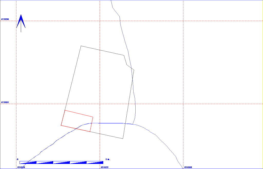
| Length | 170 | Width | 162 | Depth | 16 | ||
| Area | 2.75 sq. m | Volume | |||||
| Material Culture | Number of Objects | 1 | Number of Animal Bones | 0 | |||
| Environmental | |||||||
| 011BD02000 | ||||||
| 011BD02001 | ||||||
| 011BD02002 | ||||||
| 011BD02004 | ||||||
| 011BD02006 | 011BD02007 |
The matrix diagram above shows an extract of the spits and layers from a small area in 11BD indicating their relationships to each other. Click on the spit number which you wish to see in more detail. The bold, flashing (Netscape browser only) context indicates the current catalogue entry. If you wish to see the full spit matrix for areas 11AD (1990), 11BD (1991) and 11CD (1992), then click here.
| KEY_ID | TYPE | SHAPE | L | B | D | PROFILE | NOTES |
| 011BD02003 | LAYER | SQUARE |
170
|
162
|
16
|
FLAT | LAYER AT SOUTH END OF FLOT SUMP TRENCH. GREY-BROWN CONTAINS IRON PAN AND STAINED CHALK. DEEPEST AT N END. APPEARS TO MERGE WITH 2002. |
| KEY_ID | OB | PERIOD | MATERIAL | TYPE | SUB_TYPE | CLASS | No |
| 011BD02003 | AA | STONE | STONE |
1
|