|
|
 |
||||
Evaluating the Landscape in the Vale of PickeringLRC Project EH2804 funded by English Heritage Archaeology Commissions Project Completed 2007
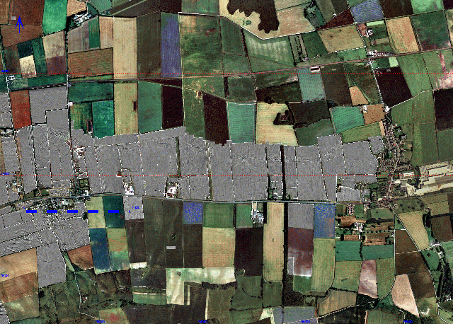
This project is primarily concerned with geophysical survey of the area between the villages of East Heslerton and Sherburn. It has provided the first glimpse of what edge-to-edge geophysical survey can achieve in this landscape. The primary objective of the project has been to gather, plot and interpret geophysical data covering an area of sands and gravels between the foot of the Yorkshire Wolds and the edge of the wetlands that once extended over much of the base of the Vale of Pickering. Air photographic survey, undertaken from 1978 onwards had identified crop-marks revealing a major linear settlement, dating from c.500BC-500AD following the edge of the wetlands with prehistoric cemeteries lying further to the south. The geophysical survey has revealed an immense amount of detail not visible in the crop-marks allowing us to identify the real density of past activity within the landscape. The remarkable results emerging from this project inspired the development of a second but linked survey project Project 3409 covering the area between West and East Heslerton with additional components including surface and sub-surface modelling designed to recover data that has allowed us to assess the degree of preservation of the archaeological deposits which in places have been protected from damage from modern agriculture where they have been buried in the past by wind-blown sands. The geophysical results of the two surveys combined combine to form the largest survey of its kind undertaken in Britain. The results from this project include:
These surveys reveal an intensity of human settlement from the Neolithic to Mediaeval periods that is unparalleled. They also alert us to the fragility of this past evidence and the threat posed by mineral extraction and intensive agriculture; however they do provide us with a base data set that can be used to develop sustainability through long term land management strategies. |
||||
