|
|
 |
|||||
Digital Information Technology in Field ArchaeologyLRC Project EH3065 funded by English Heritage Archaeology Commissions with additional support from The Handspring Foundation, and Fuji (UK) Full Report now available on Internet Archaeology A project evaluating the potential of digital field recording techniques applied to the archaeology of the Iron-Age, Roman and Early Anglo-Saxon periods in Eastern Yorkshire. IntroductionIt can be argued that whilst the practice of field archaeology is an art, the process is a science; field archaeology is distinguished by the fact that each excavation is an unrepeatable experiment, an experiment which relies on the destruction of much of the evidence being examined as a fundamental part of the process. The field archaeologist has a responsibility to preserve each site through its records by careful and rigorous documentation. No two trenches are identical and whilst sites of the same class may be similar in layout, form or function each will have its own unique combination of geology, soils and human intervention which will combine to make excavation of each a unique challenge. As archaeology has matured the level of information required to support analysis and interpretation has increased; with this the level of documentation required has also radically expanded. Given the fact that there is only one chance to observe and document any particular deposit or feature, recording can only realistically be undertaken in the field. For more than 15 years excavations undertaken as part of the Heslerton Parish Project have pioneered the use of hand-held computers in the field, replacing the paper record with digital records which enable analysis to be undertaken as part of the excavation rather that at a post excavation stage. Now that the computer is as commonplace in archaeology as the trowel the DigIT project has been instigated to evaluate the current state of the art in digital recording equipment and approaches. The project combines a group of small excavations undertaken as part of a long term research programme into the evolution of the landscape of Eastern Yorkshire with a series of digital recording experiments; building on the work undertaken over the last 23 years testing new approaches and hardware not previously available, applied directly in the field.
Archaeological Trenches and ObjectivesThe DigIT excavation is underpinned by over 15 years of excavation, analysis and understanding of the archaeology of the Heslerton Parish in the Vale of Pickering and forms part of a continued drive to understand the archaeology of the region in the context of the landscape in which it exists. Perhaps surprisingly the seemingly empty fields you drive past are crammed with dense occupation and evidence of use and disuse throughout time, mostly centered around the Iron Age, Roman, Anglian and Saxon periods. Unfortunately this density of evidence attracts not only the inquisitive methodical archaeologist but also the undesirable attentions of prospectors and hobbyist metal detectors. For this reason we must keep the exact location of our investigations secret, the temptation to do some 'research' of their own is often too great and useful data is lost through unrecorded cherry-picking. We will at least attempt to convey our findings within their context and our results will be put in the public domain once our work is done. The first site in this new phase of research lies between Yedingham and Sherburn on the southern side of the Vale of Pickering, North Yorkshire and is on the same alignment as the Anglian 'ladder' settlement which formed the focus of the West Heslerton Excavations.
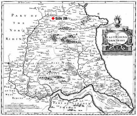
Location of site 28 in the Vale of Pickering (from Robert Morden 1695) Sites such as this are under threat of accumulative destruction from plough damage, and one of the aims of these investigations is to look into identifying and protecting the archaeological resource whilst also furthering understanding along the lines of the research aims set out in the Heslerton Parish Project.
Trench AA
Trench AB
Trench AC
|
|||||
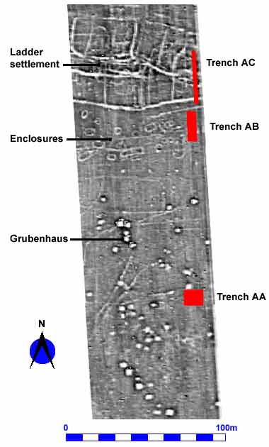
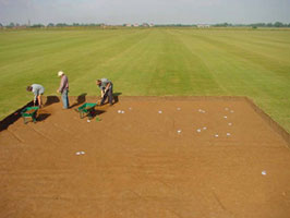 Trench AA was located over three geophysical anomalies which showed from the geophysical survey as likely to be Grubenhäuser. The Grubenhaus is the most distinctive feature type found in early Anglo-Saxon settlements, the name, from the German, meaning effectively ' hole in the ground house is somewhat deceptive. Evidence from the nearby excavated village at West Heslerton and elsewhere shows that these features which can measure up to 5 x 4 metres in area and over a metre deep were dug out to facilitate the creation of cavity floor buildings above. The buildings, which appear to have had turf walls, are thought to have been used for a variety of purposes including grain storage, and other more general purposes associated with craft, industry and everyday life. The material filling these large rectangular features used to be thought to be derived from the building above and therefore associated with the use of the building, it has now been proven that most of the material contained in the pits is derived from manure heaps where it may have lain for many years before being discarded into the pit left after the building had decayed or been deliberately dismantled. It is likely that this material may have been derived from cleaning up areas where manure heaps had been maintained for the purpose of night-soiling; disposal of domestic and animal refuse on the fields as organic fertiliser. Although we no longer consider the material in these features to be associated with the buildings that once stood over them, this is the primary resource for evidence of daily life in these settlements including ceramics, animal bone, plant remains and other finds.
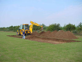 Trench AB is positioned to investigate a series of circular and sub-rectangular enclosures which lie directly to the south of the 'Ladder Settlement'. These have not been investigated prior to the DigIT project and their function is something of a puzzle, a couple of suggestions put forward are that they may represent Hay-rick gullies (the draining ditches around hay-stacks) or that they may represent burial monuments, from the Iron Age or Roman period. If these features turn out to be associated with burial in this period then they are of considerable importance since we currently know nothing of the burial practices during these periods in rural Eastern Yorkshire.
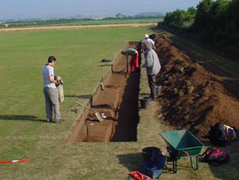 The location of trench AC shows a pattern of linear or curvelinear features on the geophysical survey results which is indicative of the extensive 'Ladder' type planned settlements found along the south side of the Vale of Pickering . Ladder settlements are a feature of the landscape of Eastern Yorkshire where they seem to have developed alongside major trackways established during the Late Bronze or Iron Age with occupation continuing until the Early Anglo-Saxon period.