|
Mapping the risk and characterising the potential ~ aggregates, palaeoenvironment and archaeology of the Vale of Pickering
LRC Project EH5288 funded by English Heritage from the Aggregates Levy Sustainability Fund with additional support in kind from North Yorkshire County Council, The Soil Survey of England and the Environment Agency
Project Summary
The Vale of Pickering is one of the two primary sources of aggregates in North Yorkshire. Archaeological research over nearly 30 years around West Heslerton has identified in one small part of the Vale of Pickering one of the highest concentrations of evidence of past human activity identified in Europe. The archaeological research in Heslerton, which was triggered by the chance discovery of an Anglian (C 5th to C 7th) cemetery during aggregate extraction, has confirmed a direct correlation between aggregate bearing soils and the most intensive areas of human settlement. The evidence accrued at Heslerton will divert pressure towards other aggregate bearing resources in the lower valley where cemeteries and settlement sites occur on low sand and gravel islands near the palaeochannels and palaeolakes that once dominated the landscape of the lower valley.
Current knowledge suggests that these palaeochannels and palaeolakes contain a rich but rapidly disappearing environmental resource from the Palaeolithic to the Medieval periods; this material, surviving within peats and waterlogged soils, are at risk from aggregate extraction and resulting draw-down of the water table, a situation exacerbated both by global warming and excessive drainage.
This project, which is only made possible by unprecedented co-operative agreements with a number of organisations and data providers, aims to create a series of new maps and flood models that identify and characterise the palaeoenvironmental resource and the archaeological sensitivity of the sands and gravels of the Vale of Pickering.
At the same time the project is assessing and developing methods that can be applied to similar landscapes elsewhere in England and investigate new methods of survey; particularly new approaches to geophysical survey employing a multi-probe wheeled gradiometer.
The project is designed to generate new knowledge derived from the combination of a variety of different resources which will be distributed to all the project partners and will contribute to the development of sustainable approaches to the management of the archaeological resource within an expanding need for the production of locally sourced aggregates.
Project Objectives
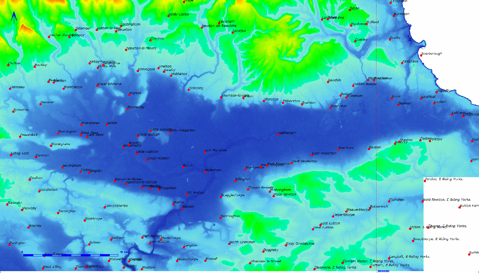
The Vale of Pickering and surrounding hills, the Yorkshire Wolds to the south, the North Yorkshire Moors to the north and the Hawardian Hills to the south-west, covers an area of about 1600 square kilometres. The Vale of Pickering is an unusual drainage basin as the principal river, the Derwent, drains not towards the sea to the east but inland towards the Vale of York. Prior to the last Ice Age the the Vale had drained into the sea near Filey, however, as the ice sheets and glaciers receded at the end of the Ice Age, lateral moraines were left which blocked the outflow towards the sea and the Vale filled with water to a depth of more than 40 metres before forming a drainage channel through what is now the Kirkham Gap through which the Derwent flows today. The Vale of Pickering contains large resources of aggregates, both in the form of sands and gravels and also quarried and crushed limestone and chalk from the surrounding hills.
The current research builds upon extensive research undertaken over more than 30 years and supported by the English Heritage Archaeology Commissions, (Heritage Enabling Programme HEEP), The Aggregates Levy Sustainability Fund (ALSF), and at Cook's Quarry, West Heslerton, by the mineral operator under planning arrangements determined through PPG16. Past research has been focussed particularly upon the area between West Heslerton and Sherburn situated between the north facing scarp of the Yorkshire Wolds and the wetlands that once dominated the centre of the Vale of Pickering. Whilst research in Heslerton was initially concentrated on rescue excavation, undertaken ahead of sand and gravel extraction and in areas suffering from active plough damage, a programme of extensive landscape survey designed to reveal the wider context of the excavated areas was initiated during 1978. Since 2001 a series of large scale projects supported both by HEEP and the ALSF and drawing upon a large archive of air-photographic and other remote sensing data augmented by large area geophysical surveys have revealed the most detailed picture of an archaeological landscape of this scale in Europe. The combined air and ground based surveys have demonstrated the preeminent role of aggregate bearing areas for human settlement from the prehistoric until medieval periods but also reveal areas where the high water table, particularly in the past, which were unsuitable for human habitation and thus could form more archaeologically sustainable resource for future mineral extraction. These projects relied upon the integration and a analysis of multi-faceted datasets derived from airborne and ground based remote sensing as well as relatively new data sets such as Lidar. The results of this research challenge our every perception of the density, intensity and continuity of settlement in Britain and although covering a large area they remain in isolation and thus are at risk of being as a somehow unique reflection of past activity in one location than representative of the broader picture.
This project was designed very much as a pilot project designed to test the levels of archaeological activity associated with aggregate bearing areas around the Vale of Pickering as a whole.

|
