Alluvial deposits
|
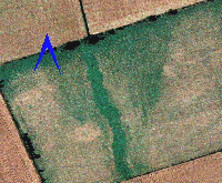
Soils deposited by water such as rivers and streams, or at lake margins and in wetland areas.
|
Anomaly

|
A term used to describe features identified within remote sensing data. An anomaly is by definition different to what is around it. Anomalies can be archaeological, geological or alluvial in origin
|
Artefact
|
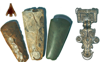
Any material modified or manufactured by people.
|
ATM
|
An acronym for Airborne Thematic Mapper, which is a remote sensing device, normally carried and used from within an airplane.
|
Barrow
|
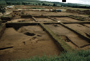
A funerary monument originally defined by a mound. They are usually made by digging a ditch around the barrow and using the soil to construct the mound. In the Vale of Pickering most barrows have been flattened, although many can be seen as low mounds on the Wolds. The ditch is often infilled with different material and can be detected using geophysics and aerial photography. A number of differently shaped barrows were constructed at different periods, with long barrows constructed in the early Neolithic, round barrows in the early Bronze Age and square barrows in the Iron Age.
|
Barrowlet
|
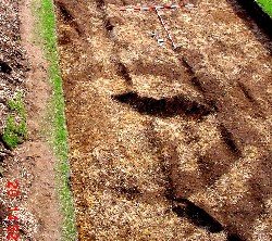
A term coined by the Landscape Research Centre for a specific form of late Iron Age/Romano-British cremation barrow. These can be circular, ovate or rectangular in shape.
|
Cropmark
|
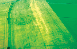
Crops grow differently over archaeological features. This is because the material making up a feature is different to the soil around it. If it is moister and richer in nutrients the crop growing over the feature will grow better, if it is drier with less nutrients it will be shorter than the rest of the crop. For example, a crop growing over an infilled ditch will be taller and more lush than the crop around it whereas a crop growing over a stone wall will be shorter. These differences are recorded using aerial photography, where they are most readily appreciated, although occasionally they can be seen at ground level.
|
Cremation
|
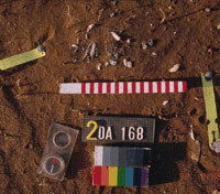
Burnt human remains. Generally all that remain are small fragments of burnt bone. Sometimes these are deposited in urns, baskets or bags. Some also contain grave goods, either burned with the body or deposited afterwards, although many are unaccompanied. The rite was prevalent at a number of different phases, sometimes used concurrently with inhumation.
|
Croft and toft
|
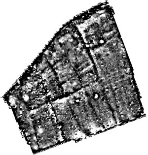
Used to refer to medieval settlement. The toft refers to the land on which the house was built, the croft is the adjoining plot of land used for pasture or arable. Generally seen as narrow parallel strips of land.
|
DMV
|
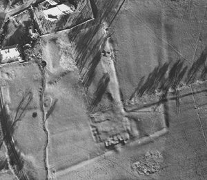
Acronym for DesertedMedieval Village. Generally the area is defined by earthworks, though this is not always the case. Other forms are crept or shrunken medieval village, where the village has either moved from its original location or contracted to a central core.
|
DN
|
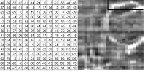
An acronym for digitalnumber. This refers to the numbers contained within the various remote sensing files, which are used in image processing. The numbers will vary depending on which technique is being used (ie nanoTesla for magnetic surveying). The numbers (raw data) from each form of remote sensing require some form of processing in order to be visualised in a way that the human eye can understand, (at the base level, they must be converted into some form of either colour or greyscale image).
|
Dry valley
|
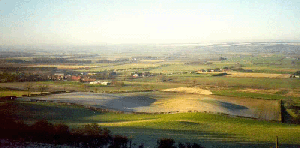
A shallow valley with no running water at the base. The dry valleys on the Wolds and at the southern edge of the Vale of Pickering are often filled with hillwash, which can preserve archaeological deposits.
|
Grubenhaus (plural: Grubenhäuser)
|
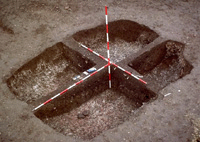
A distinctive form of Anglo-Saxon structure defined by shallow, sub-rectangular pits often with a posthole at either end. These pits probably formed a cavity beneath the floor of the structure supported by the posts to keep the interior dry. They have been interpreted as stores, granaries and general purpose sheds. After use they were often infilled with rubbish from the settlement, which accounts for their generally high magnetic signal.
|
GPS
|
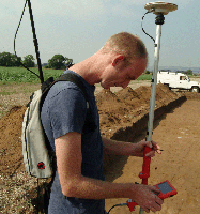
An acronym for global positioning system, used for surveying. Calculates the position of the receiver on the earth surface by triangulating from a number of satellites orbiting the planet. To improve the accuracy differential GPS (DGPS) systems use an additional fixed receiver. In some systems accuracies of less than a centimeter can be achieved.
|
Henge
|
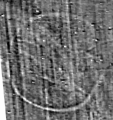
A circular enclosure defined by a bank on the outside and a ditch on the inside with one, two or four entrances.
|
Hengiform
|
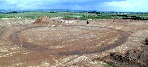
A term applied to any circular enclosure defined by a ditch with one or more entrances, thus having the form of a henge. These can vary in size from as little as seven metres in diameter.
|
Hillwash (or colluvium)
|
Soil that has been eroded and washed down slopes by water. This forms a deposit that forms at the base of the slope, in dry valleys and gullies
|
Inhumation
|
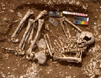
Deliberately buried human remains within a grave pit constructed specifically for the purpose.
|
Ladder settlement

|
Used to describe a distinctive form of late Iron Age/Romano-British settlement based on a linear trackway. The enclosures are attached to either side of the trackway, and in places this looks like a ladder. In other parts of the country they area also known as spinal settlements.
|
LiDAR
|
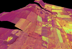
An acronym for LightDetection and Ranging, which uses a laser to collect 3-dimensional points for the creation of digital elevation models and surfaces.
|
Linear
|
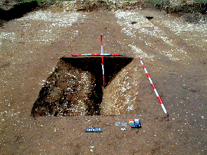
A term used to define features or anomalies forming a line, such as ditches or walls.
|
Long barrow
|
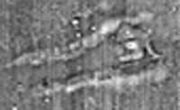
A barrow of early Neolithic date, characterised by a long mound with two flanking ditches. They generally have a façade to the east, where the opening into the burial mound was located.
|
Palimpsest
|
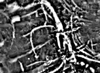
A term used in archaeology to describe a complicated sequence of features from different periods which are superimposed over each other.
|
Pit alignment
|
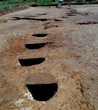
A linear alignment of pits. These range in date from the later Neolithic through to the Iron Age. They appear to define large areas, or sometimes follow natural features like stream channels, and in the final phase are often replaced with ditches.
|
Pixel
|
An acronym for picture element. These make up the constituent parts of a raster image, and are generally either square or rectangular in shape. They are also used to define screen resolution of monitors and the resolution of digital cameras.
|
Polygon
|
A term used in vector drawing to define a closed area of any shape.
|
Posthole
|
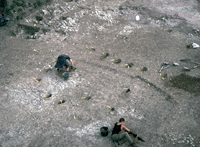
A hole dug to take the lower end of a post. If the post is not removed it will rot away and leave a post pipe, a darker deposit within the fill of the hole. Often the post holes are in groups, indicating the presence of structures
|
Raster
|
A term used for images which are made up of pixels, which can be either square or rectangular in shape
|
Relict stream channel or palaeochannel
|
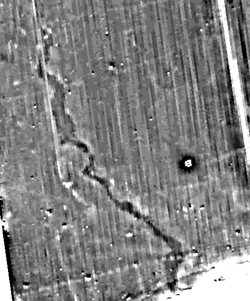
A relict stream channel marks the old course of a stream. A spring line at the foot of the Wolds gives rise to a number of these streams, some of which remain active today, although many are now dry. The paleochannels in our project zone are dried up or diverted segments of the River Derwent system, now channeled in the centre of the Vale of Pickering.
|
Remote sensing
|
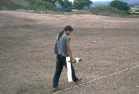
A term generally applied to all forms of non-intrusive survey. This encompasses geophysics, aerial photography, multi-spectral survey and satellite imagery.
|
Ridge and Furrow

|
A medieval system of arable farming. Soil was formed into ridges with a furrow on either side by ploughing. This also served as a system of land tenure, where tenants rented a number of the strips defined by the furrow
|
Round barrow
|
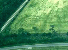
A barrowdefined by a circular ring ditch. These are generally of early Bronze Age date, although some larger Neolithic examples exist.
|
Square barrow
|
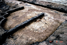
A specific class of middle Iron Age barrow defined by a square ditch with a single inhumation in the centre. Rarely these are known to contain chariot or cart burials.
|
Stratigraphy
|
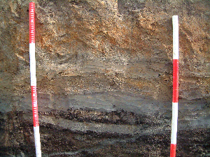
The chronological order of superimposed deposits, features and layers, generally with the earliest layers at the bottom and later layers towards the top of the sequence, although these can be jumbled in stream channel deposits.
|
SQL
|
An acronym for SequentialQuery Language. Used to extract the results of specific queries from a database.
|
Total station
|
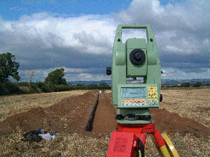
An advanced type of theodolite which electronically records distances and angles, using them to calculate co-ordinates. Modern total stations are used in conjunction with GPS devices to provide accurate real space co-ordinates.
|
Vector
|
A term used in computer drawing to define a line, polygon or shape which exists in real space.
|
