
|
|
| Spit Details | |||||||
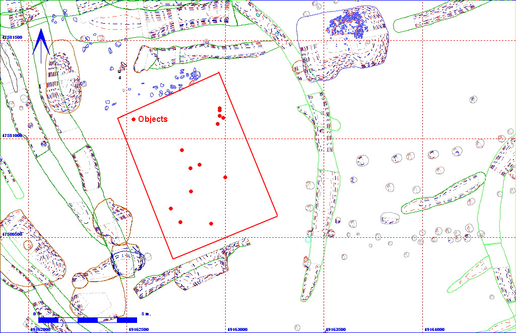
| Length | 760 | Width | 675 | Depth | 5 | ||
| Area | 51.3 sq. m | Volume | |||||
| Material Culture | Number of Objects | 14 | Number of Animal Bones | 0 | |||
| 012AD00001 | |||||||||||||||||||||||
| 012AD00385 | 012AD00390 | ||||||||||||||||||||||
| 012AD00669 | 012AD06214 | 012AD06110 | 012AD06079 | 012AD06080 | 012AD06149 | 012AD06213 | 012AD00653 | 012AD00652 | 012AD06103 | ||||||||||||||
| 012AD06139 | |||||||||||||||||||||||
The matrix diagram above shows an extract of the spits from Area 12AD indicating their relationships to each other. Click on the spit number which you wish to see in more detail. The bold, flashing (Netscape browser only) context indicates the current catalogue entry.
| KEY_ID | TYPE | SHAPE | L | B | D | PROFILE | NOTES |
| 012AD06007 | SPIT | RECTANGULAR |
760
|
675
|
5
|
U-SHAPED | SPIT ON WESTERN EDGE OF AD AT CHALK/HILLWASH INTERFACE. CONTAINED POTTERY ANIMAL BONE AND LUMP OF BURNT SANDSTONE. |