Two case study areas are supplied as downloadable data files in an x, y value comma separated file format. Because these contain a large number of points, they are provided as zip files, so you will need to have something which can unzip them before processing. You will have to use one of the commercial software packages if you want to play with the data. These include Geoplot, available from Geoscan Research, or you may wish to use your own proprietary software.
In order to compare the results, sample area one covers the same area as the example used in the multi-spectral pages. The magnetic data for the southern half of the sample area is available as an x, y, value comma separated file on the download page (Site 005_xyz_magnetic_data.zip). The file has been zipped to facilitate download speeds.
For those of you who do not have access to magnetic processing software, we have included images of the three stages of processing below, to allow you to see how the data is manipulated.
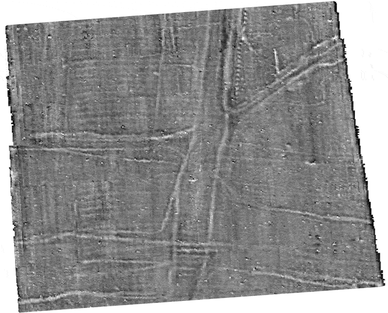
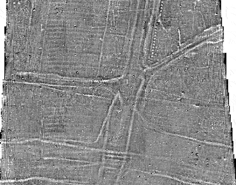
The image above shows the unprocessed data as it was downloaded from the Bartington Grad 601-2 fluxgate gradiometer. The linear (lighter) straight lines which can be seen in some parts of the survey data are the result of a combination of a slightly poor zero reference point combined with one of the two sensors drifting at a different rate from the other. A destriping algorithm is necessary to deal with these.
The image above shows the data after the destriping algorithm has been applied. Also the data have been clipped so that anything less than -6.4 nT is shown as black and anything greater then 6.4 nT is shown as white, which gives a greater clarity to the anomalies in the centre of the image.
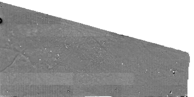
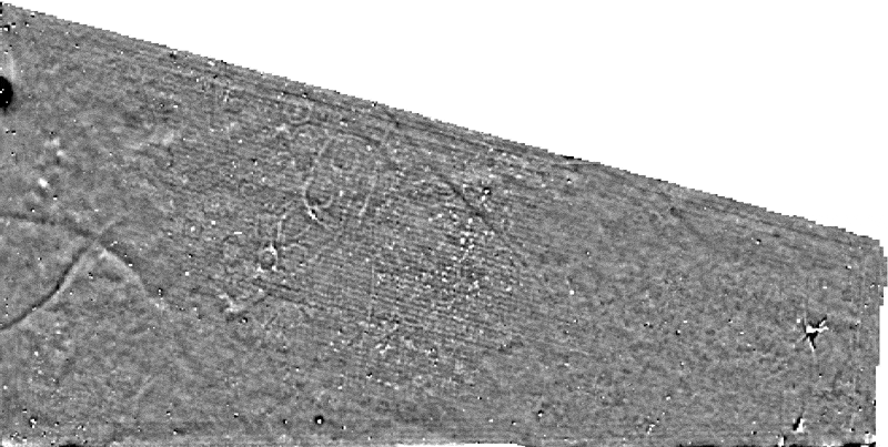
Below is part of the fully rectified image, with additional survey in the upper half, showing an area directly comparable to the multi-spectral example. The arrows indicate the presence of a group of square barrows (left) and a cluster of small round barrows (right). For full comparisons of all the remote sensing techniques, go to magnetic comparisons 1.
The magnetic data for this sample area is available as an x, y, value comma separated file on the download page (Site 020_xyz_magnetic_data.zip). The file has been zipped to facilitate download speeds.
For those of you who do not have access to magnetic processing software, we have included images of the three stages of processing below, to allow you to see how the data is manipulated.
The image above shows the unprocessed data from the FM36 fluxgate gradiometer, although a zero drift algorithm has been applied to the data. Note that in this case a number of the grid squares in the survey area suffer from a staggering effect.
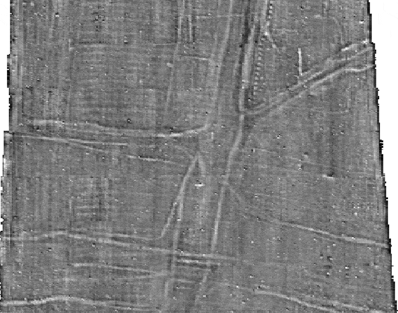
The image above shows the data after a destaggering routine has been applied. Also the data have been clipped so that anything less than -12.8 nT is shown as black and anything greater then 12.8 nT is shown as white, which gives the image a smoother look.
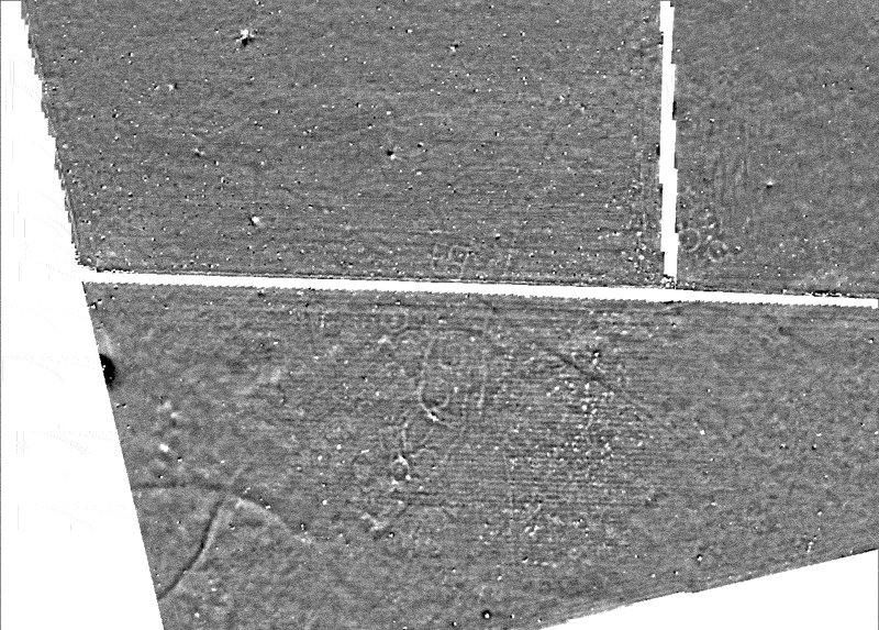
Below is the fully rectified image. This can be directly compared with the multi-spectral data and the aerial photographic data for the same area.