Characterising the Landscape: Village and Farmstead
Early Anglo-Saxon settlement patterns
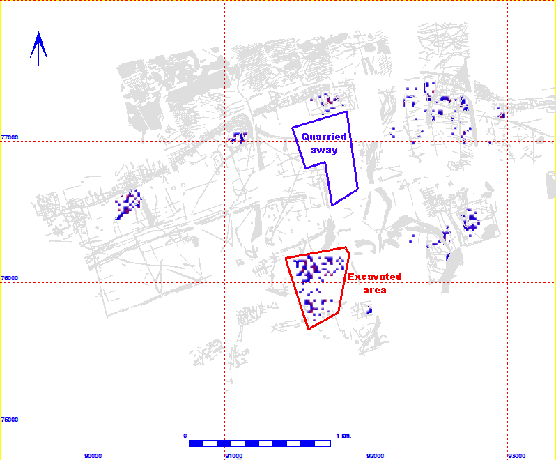
The Anglo-Saxon Grubenhaus, a type of cavity floor building that is almost the defining characteristic of Early and Middle Saxon settlement, generates a highly distinctive magnetic signal. Including the 140 examples excavated at West Heslerton the combined survey projects 3409 and 2804 have identified more than 750 of these buildings within an area measuring 6x1.5km. In addition to the two large settlements, the excavated example at West Heslerton and a second, slightly larger example, between east Heslerton and Sherburn, there are smaller clusters of these buildings immediately to the south of the 'ladder settlement' every seven to eight hundred metres and another group to the south of East Heslerton which are probably Middle Saxon. That these characteristic rectangular anomalies are indeed showing Grubenhäuser has been tested and confirmed in two locations one in each project area; in both cases the excavated examples were Early Anglo-Saxon. The Early Anglo-Saxon settlement settlement pattern is clearly far more complex that we have thought, whether these smaller clusters represent farmsteads in the landscape, contemporary with the larger 'villages' or alternatively the earliest phase of settlement growing out of the ladder settlement, prior to nucleation, can only be determined through excavation. Careful excavation supported by an extensive dating programme would be required if we are understand the relationship between these clusters of activity. The idea that these smaller groups of structures might represent buildings in the fields can now be discounted, there are simply too many of them in clusters that are too well defined.

The density of Grubenhäuser calculated per 20m square. (data range 1-dark blue to 6-red)
|
