 |

| Spit Details | |||||||
| Length | 960 | Width | 540 | Depth | 3 | ||
| Area | 60.8 sq. m | Volume | |||||
| Material Culture | Number of Objects | 15 | Number of Animal Bones | 0 | |||
| Environmental | |||||||

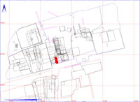
The matrix diagram above shows the spits outlined in red and their relationships to each other. Click on the spit which you wish to see in more detail.
| KEY_ID | MATERIAL | PERIOD | No |
| 002CA00811 | FLINT | PREHISTORIC |
2
|
| MINERAL | Unassigned |
1
|
|
| POTTERY | ROMAN |
2
|
|
| SLAG | Unassigned |
2
|
|
| STONE | Unassigned |
8
|
| KEY_ID | TYPE | SHAPE | L | B | D | PROFILE | NOTES |
| 002CA00811 | SPIT | RECTANGULAR |
960
|
540
|
2
|
FLAT | SPIT TO S OF SPIT 810. FINDS OF BONE POT AND FLINT. DIRECTLY UNDER SPIT 88. |
| KEY_ID | OB | PERIOD | MATERIAL | TYPE | SUB_TYPE | CLASS | No |
| 002CA00811 | AG | PREHISTORIC | FLINT | FLAKE | 1 | ||
| 002CA00811 | AI | PREHISTORIC | FLINT | CORE FRAGMENT | BLADE CORE | 1 | |
| 002CA00811 | AF | Unassigned | MINERAL | CALCITE | 1 | ||
| 002CA00811 | AB | ROMAN | POTTERY | SHERD | ROMANO-BRITISH | 1 | |
| 002CA00811 | AE | ROMAN | POTTERY | SHERD | IA/R-B | 1 | |
| 002CA00811 | AD | Unassigned | SLAG | SLAG FRAGMENTS | IRON SLAG | 2 | |
| 002CA00811 | AH | Unassigned | SLAG | SLAG FRAGMENT | IRON SLAG | 1 | |
| 002CA00811 | AA | Unassigned | STONE | STONE | 1 | ||
| 002CA00811 | AC | Unassigned | STONE | STONE | SANDSTONE | 1 | |
| 002CA00811 | AJ | Unassigned | STONE | STONE | SANDSTONE | 1 | |
| 002CA00811 | AK | Unassigned | STONE | STONE | 1 | ||
| 002CA00811 | AL | Unassigned | STONE | STONE | 1 | ||
| 002CA00811 | AM | Unassigned | STONE | STONE | 1 | ||
| 002CA00811 | AN | Unassigned | STONE | STONE | 4 | ||
| 002CA00811 | AO | Unassigned | STONE | STONE | NAT IRON | 1 |