
| Ditch Details | |||||||
| Length | 200 | Maximum Width | 50 | Maximum Depth | 8 | Profile | U-shaped |
| Material Culture | Number of Objects | 0 | Number of Animal Bones | 1 | |||
| Environmental | |||||||
| CUT | FILL | VOLUME | OBJECTS | AN BONE | DENSITY |
| 012AC00114 | 012AC00113 | 0 | 1 |
| KEY_ID | TYPE | SHAPE | L | B | D | PROFILE | NOTES |
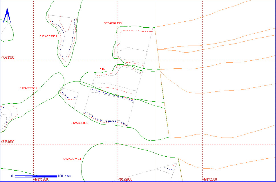
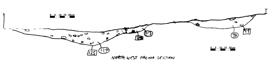
| 012AC00113 | GULLY FILL | COMPLEX |
200
|
50
|
8
|
U-SHAPED | DITCH FORKING WITH 124 AND MERGING WITH THE TERMINATION OF 98. RELATIONSHIP UNDEFINED |
| 012AC00114 | GULLY CUT | COMPLEX |
200
|
50
|
8
|
U-SHAPED | SHALLOW GULLY FORKING WITH 125 AND MERGING WITH TERMINAL OF 99 |
| KEY_ID | SPECIES | ELEMENT | QUANT |
CHEW
|
BURN | BUTCH | FBRK |
| 012AC00113 | Horse | Tooth | 1 |
0
|
0 | 0 | 0 |