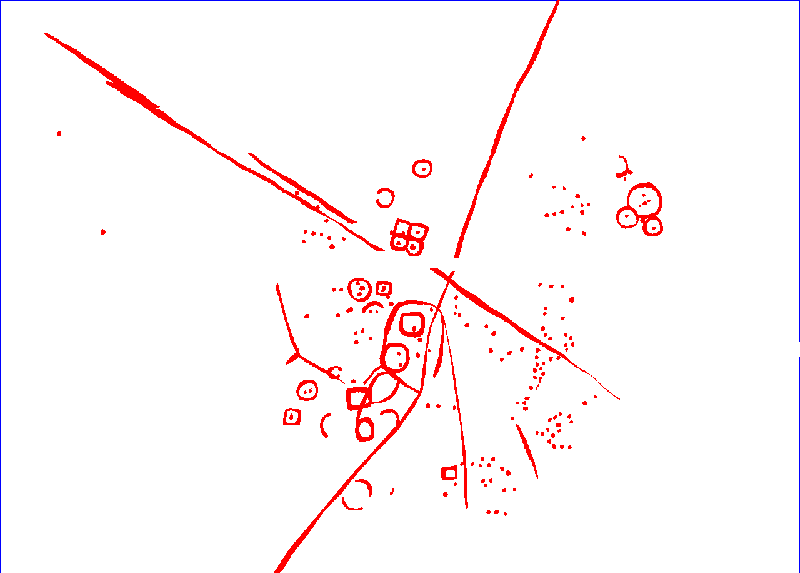
The image above shows the magnetic data for sample area one. The main southern site is not as well defined the returns from the aerial photographs. However, in the central northern field a small group of square barrows has been clearly defined, and in the corner of the north-eastern field a cluster of small round barrows not seen in the aerial photographs has been detected. In addition, a group of localised anomalies to the east of the main site were only detected magnetically. The image below is of all anomalies interpreted as having an archaeological origin, thus geological and alluvial anomalies are not indicated.
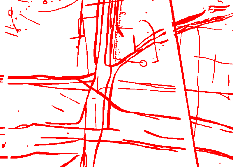
The image above shows the magnetic data for sample area one. A complex sequence of trackways and pit alignments is revealed, although in some cases pit alignments known to exist from the aerial photographic evidence are seen as continuous linear anomalies. The image below is of all anomalies interpreted as having an archaeological origin, thus geological and alluvial anomalies and anomalies caused by modern disturbance are not indicated.